
FOFN
🌍

Cross-Border Transportation

For international trucks, tractors, refrigerated vehicles, and cross-border logistics fleets—enabling vehicle location tracking, transport route monitoring, border crossing points and transshipment zones, detection of abnormal stops, and device status visibility.

Cross-Border Transportation

How to manage vehicle location and transport nodes across borders?

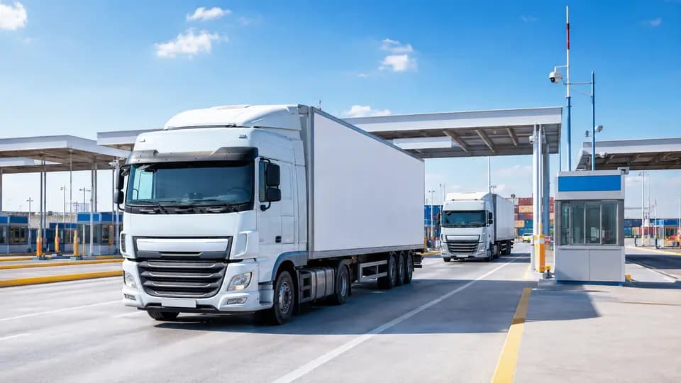
Cross-border vehicles traverse multiple countries, border checkpoints, logistics parks, and transshipment warehouses—where network handovers, border waiting periods, or extended stops may occur. The FOFN Cross-Border Transportation GPS Tracking Application, integrated with in-vehicle telematics devices, enables real-time visibility into vehicle location, historical routes, stop locations, and device status—supporting dispatch coordination, shipment progress tracking, and anomaly investigation.

Which business scenarios does it suit?

Ideal for international road freight, cross-border logistics, TIR transport, bonded transportation, international cold-chain logistics, and multi-country fleet operations. Geofences can be configured around border checkpoints, warehouses, logistics parks, customer addresses, or custom route zones to automatically log vehicle entry, exit, and dwell events.

What should be considered when selecting equipment for cross-border projects?

Before project launch, confirm network coverage, carrier frequency bands, SIM roaming capability, vehicle power supply specifications, and device mounting conditions in target countries. GPS tracking supports location and route management but does not replace customs declaration systems, border clearance platforms, insurance solutions, or country-specific regulatory compliance systems.

Key Features:

Real-Time Vehicle Location

View vehicle position, online status, and last update time—based on device configuration, satellite signal strength, and local network conditions.

Historical Route & Dwell Recordings

Review transport routes, border checkpoint wait times, transshipment dwell durations, and timestamps for vehicle entry into subsequent transport zones.

Border Checkpoint & Transshipment Zone Management

Configure geofences around border checkpoints, warehouses, logistics parks, customer addresses, or designated geographic areas.

Abnormal Dwell & Route Verification

Monitor prolonged stops, geofence breaches, unauthorized movement, or device offline events using configurable platform rules.

Device & Communication Status

Check terminal online status, last communication timestamp, and basic device health indicators—supporting cross-border route verification.

Multi-Country Fleet Group Management

Organize fleets by country, transport route, customer, fleet ID, or vehicle type.

What GPS tracking delivers

Real-Time Positioning

View the precise location of vehicles or assets on a map, refreshed every few seconds.

Route Playback

Replay historical trips, stop points, and routes to verify actual events.

Geofencing

Trigger automatic alerts when a vehicle enters or exits a predefined zone.

Fuel Monitoring

Track fuel level and consumption to prevent fuel theft and reduce waste.

Driver Behavior Monitoring

Detect harsh braking, speeding, and idling to improve road safety.

Alarm Notifications

Receive instant push notifications for tampering, low battery, offline status, and emergency events.

Recommended products

Recommended solutions

FAQ

Does the tracker work in all countries?

We support 207 countries. Device selection must be validated against the target country’s 4G network infrastructure, device frequency bands, carrier compatibility, SIM roaming capability, and local telecom regulations.

Can location data still be uploaded after vehicles cross borders?

Yes—provided the device, SIM card, and local network are compatible. Network handovers between countries or carriers may cause brief data gaps; actual performance depends on regional coverage and communication design.

Can vehicles from multiple countries be managed on one platform?

Yes. The platform centrally displays location, route, and status for all connected vehicles. Map data, time zones, user permissions, and reporting rules can be configured per platform capabilities.

Can GPS data be used for customs declaration or clearance?

GPS provides verifiable vehicle location and route records that may be submitted to customs authorities.

Will route data be lost in weak- or no-network areas?

Terminals with onboard storage or blind-spot data recovery can upload cached records upon network restoration—supporting up to 10,000 offline data points.

Can the system integrate with our existing TMS, logistics, or fleet management platform?

Yes. Integration options—including TCP, UDP, API, or protocol-level对接—can be assessed based on terminal model, communication protocol, server requirements, and interface specifications.